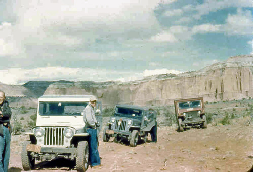
I stumbled across this neat forum article about a group of friends who decided to check out Hole-in-the-Rock, Utah, in 1955 after reading a National Geographic article (probably this one). So, in a fleet of three vehicles (looks like a 1949 CJ-3A, a CJ-3B, and a MB/GPW), they set off from Los Alamos, NM and drove to Escalante, Utah, before venturing into the Hole-in-the-rock area. Most of the photos that were taken are in areas now under the water of Lake Powell.
According to the article’s author, “My jeep was a 1949 CJ3 and it was a wreck when I got it. I think it had never been lubricated. I had to replace all the universal joints and overhaul the engine. The cab was aluminum and I bought it at Sears. The red jeep was an old military model. My friend had bought it and built a wooden cab for it himself.”
I wanted to contact the author of this story, but I can’t figure out how to register (says registration is closed) to the popphoto.com forum. Furthermore, I can’t figure out to contact an administrator. I’d like to contact the guy (he was 94 as of 2007 — likely passed away by now), because he doesn’t know what to do with the photos he’s taken.
The author’s notes in a separate post, “I wish I knew some historical society or such that would be interested in the slides I have. None of my relatives and friends are interested in these things. I suppose eventually they will be put in a big cardboard box and auctioned off for a high bid of $1.”
Since that was his wish, I’m going to preserve his story in total here, so I’ve post it below. You can see the original post here: http://forums.popphoto.com/showthread.php?151510-Kaiparowits-Plateau-A-journey-from-the-archives-to-Hole-in-the-Rock-Crossing-1955 along with the follow up comments.
========================
Kaiparowits Plateau: A journey from the archives to Hole -in-the-Rock Crossing 1955
This trip was inspired from a National Geographic article in the 1950s. This magazine had several articles on little known areas of the southwest. Most were in very isolated areas with few, if any roads and trails.
A party of three Jeeps set out from Los Alamos NM to Escalante Utah. We arrived in Escalante about noon time, and then proceeded to find our way to the Hole in the Rock crossing. So named because early Mormon Pioneers lowered wagons and horses to the Colorado River, and then rafted across the river at this point.
Leaving Escalante we headed off in a South-easterly direction. The maps we had showed the distance to be approximately 50 miles.
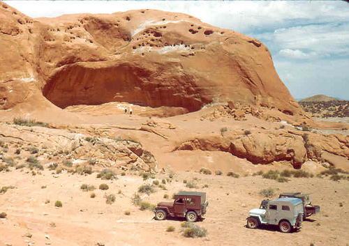
We passed some remarkable formations, This was known as Dance Hall Rock. Locals had dances here periodically.
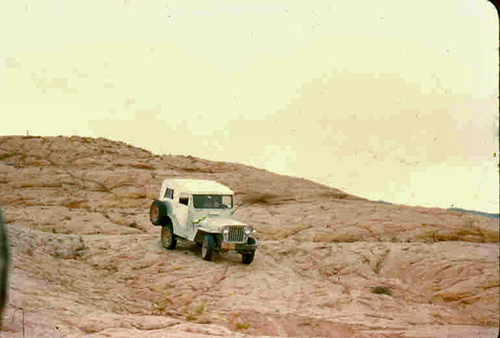
After awhile we came to the dreaded fork in the road. As we debated which fork to take, a man appeared on horseback. He asked if we knew where we were going, we said we knew where we wanted to go, but not how to get there. He gave us directions, and on we went. He neglected to tell us what obstacles we would find. After several miles, we came to an enormous outcrop of slick rock, and the tracks we were following ended there. It was obvious that we had to cross the rock, We did that rather easily.
Then followed two mile stretch of deep sand. We reached Hole in the Rock in late afternoon.
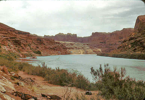
I was never fond of sleeping out under the stars, so before we started the trip, I removed the front passenger seat of the Jeep, then I had enough room for an air mattress and sleeping bag. Dark began to form back to the northwest, and before we could get settled in and cook supper we had a terrible wind and sand storm which continued all night. We had to snack on dry food like crackers and cookies. My friends were sleeping out on the ground. I was in the Jeep, but it was no where wind and sand proof, and everything and everyone was covered with fine sand. The next morning dawned bright and fair, so we prepared to decend to the river. [Editor’s Note: Compare the photo below with a modern one that shows Lake Powell.]
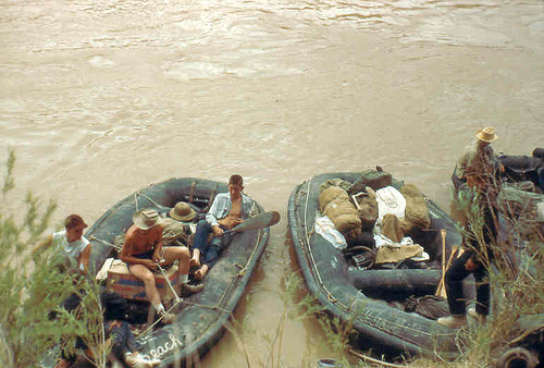
When we reached the river, there was a troop of Boy Scouts going down river by boat.
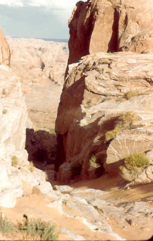
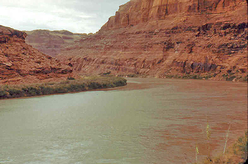
They were preparing to cast off, so we didn’t visit with them. This is the view upstream:
View downstream:
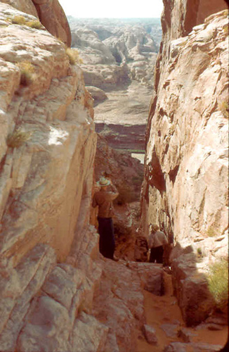
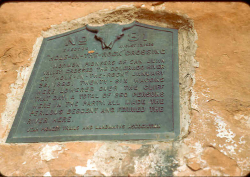
Plaque commemorating the Pioneer’s descent:
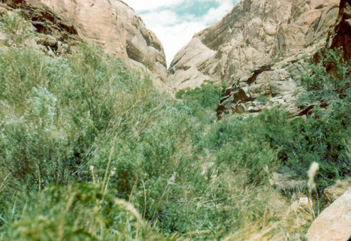
View from river to the top of the plateau:
Return trip to Escalante; Retracing the sandy stretch. The author is leaning on the white Jeep.
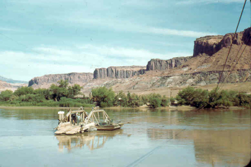
We returned to Escalante, and drove to Hite to cross the Colorado river at the Chaffin Ferry
We camped that evening at Hite, and then the next day we drove to Shiprock, spent the night in a Motel, and on home the following day.
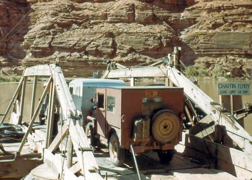
What could you do today that would be comparable to that trip?
Last activities from Toronado was 01-17-2013 04:08 PM.
Maybe try reaching his friend Fotolopithecus.
Did you tryed “Contact@popphoto.com.”?
Or send a message to the forum admin? http://forums.popphoto.com/sendmessage.php
Wow. That trip was taken when “men were men”.
Searching other post I found out his name is Bob.
and On 08-22-2011, 08:49 AM
“Gord, I too have been away for some time. I am slowing down. I passed my 92nd birthday several months ago and haven’t been very active in the photo department. A friend and I did go to Monument Valley last April. Eye problems and prostate cancer are taking their toll. I have had the cancer since about 2001 and it is winning. But I can’t complain. I will post an image, but I don’t know when.”
Don’t know how that will help you.
Thanks guys. I will track Bob down using the email Pascal found (thanks!).
– Dave
Dave,
Thanks so much for finding and posting this story. You did a fantastic job of finding a modern photo of the hole from almost exactly the same spot, too!
Another interesting aspect is that in 1955 Los Alamos was a government town with a Santa Fe mailing address. It wasn’t really opened up until 1963. It’s sole business was nuclear weapons design and testing, so these guys must have worked for Los Alamos National Lab.
Doug, that’s a good point. You know, I know someone who was a manager there. Wouldn’t that be a small world if I know someone who knew these guys!
– Dave
We ventured that area a few years ago but from the south end and saw hole in the rock from across Lake Powell. It was a fun 2-day trip and was a very desolate area. The ferry service is a bit more modern these days. 🙂
Dave,
I can’t begin to put into words how this made me feel. My family has been the ones
Contracted to do the work on the ramps and several other things in the Lake Powell
Area and the connecting hwy from Hite to Halls crossing. I was about 8 and remember
staying in our camp trailer for the summer when my dad worked that road.
I have been looking for pre lake pictures and was so excited when I came across
this story.
Thank you, thank you, thank you.
Thanks Lisa! The internet is an amazing neighborhood. I’m glad my part of the block proved useful 🙂
– Dave
Just one final note. This is in my back yard and I feel like the luckiest person to be able to live in such a diverse and beautiful state. (Minus the poligamy of course).
I lived in Salt Lake for 10 years. My kids still live there. I love exploring the back areas of Southern Utah. So, I understand how you feel.